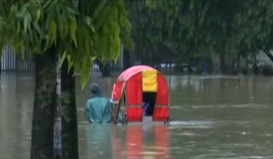
DHAKA, June 29, 2022 (BSS) - Officials said flood situation may worsen again in northeastern parts as both Bangladesh and upstream region of Indian states witnessed significant amount of rainfall in the past 24 hours.
A total of 196mm (millimetre) rainfalls were recorded at Sunamganj, 175mm Chattak (Sylhet), 129mm at 96mm at Panchagarh, 195mm at Lalakhal (Sylhet), 148mm at Dalia, 128 mm at Sylhet, 177mm at Jaflong (Sylhet), 137mm at Pateshwari (Kurigram) and 115mm at Kanaighat (Sylhet), a bulletin of Flood Forecasting and Warning Centre (FFWC) today said.
Significant rainfalls (mm) recorded during last 24 hours in Sikkim, Arunachal, Assam, Meghalaya and Tripura regions of North-East India, the bulletin added.
A total of 183 mm rainfalls were recorded at Passighat (Arunachal), 96mm at Cherrapunji (Meghalaya), 97mm at Jalpaiguri (West Bangal) and 82 mm at Dibrugarh (Assam).
Water levels at 39 river stations monitored by the FFWC have marked rise while 66 stations recorded fall.
Among the 109 monitored stations, four river stations have been registered steady while water levels at seven stations are flowing above the danger level, a bulletin issued by the FFWC said here today.
All the major rivers in the country are in rising trend except the Ganges-Padma and Kushiyara, which may continue in next 24 hours, it added.
In the next 24-48 hours, there is chance of heavy rainfall at places of the northern and north-eastern Bangladesh along with Assam, Meghalaya and Sub-Himalayan West-Bengal (Jalpaiguri, Sikkim) of India. As a result, basically the major rivers of northern Bangladesh (Teesta, Upper Atrai, Dharla, Dudhkumar, Upper Karotoa, Tangon, Punarbhaba and Kulikh) may rise rapidly at times during this period, the FFWC statement said.
The water level of Teesta river at Dalia Point, Dharla river at Kurigarm point, Dudhkumar river at Pateswari point and Karotoa river at Panchagarh point may rise and remain above or close to danger level in next 24 hours.
Flood situation in Sylhet and Sunamganj districts may slightly deteriorate, while flood situation in Netrokona, Kishoreganj and Brahmanbaria districts may remain steady in next 24 hours, the forecasting centre added.
Waterborne diseases are spreading in the flood-hit regions of Bangladesh as floodwater started receding.
"Many people are suffering from diarrhoea, skin diseases, dysentery, cholera and other waterborne diseases," Directorate General of Health Services (DGHS) sources said.
In the past 24 hours, a total of 492 people have been affected by diarrhoea in four flood hit divisions -- Sylhet, Rangpur, Chattagram and Mymensingh -- while 130 people have also suffered from skin diseases, a press release issued by the DGHS said.
To provide healthcare supports to the flood affected regions of the country, as many as 2,048 medical teams have been working since beginning of the flood, it added.
"Water levels of major rivers in the country are in rising trend at their most monitoring stations....meaning flood situation is likely to deteriorate in Bramaputra and Meghna basins. ," he added. The situation is worst since the 2004 flooding, Bhuiyan, an FFWC executive engineer, said heavy downpours inside Bangladesh and upstream region of India triggered devastating flood in Bramaputra and Meghna basins.
Monsoon rains and gushing waters from upstream India worsened Bangladesh flood situation with experts calling it one of the worst floods while millions of people have been affected by the deluge, the FFWC official said.
Northeastern and northern parts of Bangladesh may witness prolonged flood as record breaking rainfalls were recorded inside Bangladesh and upstream states of India during the ongoing flood.
"We have seen that both Bangladesh and upstream states of Meghalaya and Assam and western Himalayan regions of India recorded heavy rainfall, the highest over 100 years," Professor Md Mansur Rahman of Institute of Water and Flood Management of BUET said.
Major rivers and their tributaries of Bangladesh have no capacity to contain such huge volume of rains, which ultimately has caused massive flooding in northeastern and northern regions of the country, he added.
Mansur said there is a huge gap between Bangladesh and upstream regions of India in terms of elevation from sea level. "So, onrush of water enters Bangladesh with a faster pace, which inundated vast areas of the country in a shorter time," he added.
The hydrologist said a large number of embankments have been built in both Bangladesh and Indian regions to control flow of water of major rivers, which are the main reasons for increasing frequency of flooding.
The ongoing flood in Meghna basin may prolong as "the only exit point of flood water is Bhairab at the Megna river will take much time to pass such huge volume of flood water into the Bay of Bangal... meaning flood in northeastern region is likely to be prolonged, if the heavy downpour continue."