Sunday
22 March, 2026
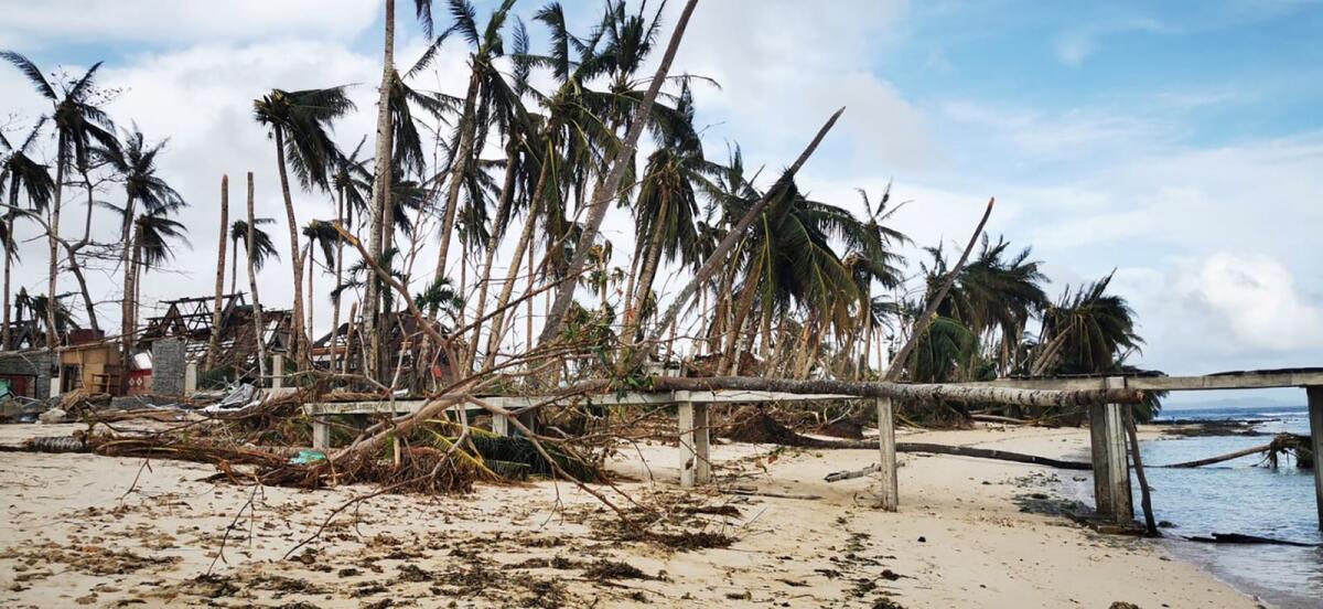
MANILA, Sept 25, 2022 (BSS/AFP) - A super typhoon barrelled towards the
Philippines Sunday and was on track to slam into the heavily populated main
island of Luzon, forcing the evacuations of coastal towns, authorities said.
Super Typhoon Noru was packing maximum sustained wind speeds of 195
kilometres (121 miles) an hour after an unprecedented "explosive
intensification", the state weather forecaster said.
The storm, the strongest to hit the Philippines this year, is expected to
continue strengthening as it makes landfall around 80 kilometres northeast of
the sprawling capital Manila in the afternoon or evening local time.
"We ask residents living in danger zones to adhere to calls for evacuation
whenever necessary," Philippine National Police chief General Rodolfo Azurin
said.
The Philippines is regularly ravaged by storms, with scientists warning they
are becoming more powerful as the world gets warmer because of climate
change.
Weather forecaster Robb Gile said Noru's rapid intensification as it neared
land was "unprecedented". The agency said it increased by 90 kilometres per
hour in 24 hours.
"Typhoons are like engines -- you need a fuel and an exhaust to function,"
said Gile.
"In the case of Karding, it has a good fuel because it has plenty of warm
waters along its track and then there is a good exhaust in the upper level of
the atmosphere -- so it's a good recipe for explosive intensification," he
said, using the local name for the storm.
- Calm before the storm -
Noru comes nine months after another super typhoon devastated swathes of the
country, killing more than 400 people and leaving hundreds of thousands
homeless.
Residents in several municipalities in Quezon province, where this latest
storm could make a direct hit, were being evacuated from their homes, said
Mel Avenilla from the provincial disaster office.
In the neighbouring province of Aurora, residents of Dingalan municipality
were being forced to seek shelter.
"People living near the coast have been told to evacuate. We live away from
the coast so we're staying put so far. We're more worried about the water
from the mountains," said Rhea Tan, 54, a restaurant manager in Dingalan.
Tan said residents were securing the roofs of their houses and boats were
being taken to higher ground while the weather was still calm.
"We're even more anxious if the weather is very calm, because that's the
usual indicator of a strong typhoon before it hits land," Tan added.
Noru could have wind speeds of up to 205 kilometres per hour when it makes
landfall, the weather bureau said.
It is expected to weaken to a typhoon as it sweeps across central Luzon,
before entering the South China Sea on Monday, heading towards Vietnam.
The weather bureau warned of dangerous storm surges, widespread flooding and
landslides as the storm dumps heavy rain.
It could damage farmlands in the heavily agricultural region, as well as
inundate villages.
Classes in some areas have been cancelled for Monday.
The Philippines -- ranked among the most vulnerable nations to the impacts of
climate change -- is hit by an average of 20 storms every year.