Friday
03 July, 2026
News Flash
News Flash
SAIPAN, Northern Mariana Islands, July 3, 2026 (BSS/AFP) - Residents of Guam and the Northern Marianas boarded up windows and stocked up on provisions Friday as a monster weather system forecast to become a "super typhoon" barrelled towards the US Pacific territories.
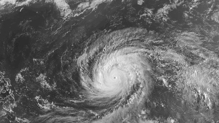
As of 0300 GMT Friday, Typhoon Bavi was moving between the Marshall Islands and the Northern Marianas, with sustained winds of 167 kilometres per hour (104 miles per hour) and gusts of 203 kph, according to the Joint Typhoon Warning Center (JTWC).
"Current forecast tracks continue to indicate a grim outlook for the Marianas," the US National Weather Service said.
"All residents across Guam and the [Northern Mariana Islands] should plan for and anticipate at least tropical storm conditions."
Moving west, by Saturday morning it was projected to have reached super typhoon status with sustained winds of 240 kph, increasing 24 hours later to 278 kph, the JTWC said, equivalent to a category five hurricane.
In the western North Pacific, a super typhoon is a tropical cyclone of 240 kph or greater, according to the JTWC.
Weakening slightly, it was forecast to hit Guam and the Northern Marianas -- still recovering from Super Typhoon Sinlaku in April -- on Monday morning.